
From Gilded Age Elegance to Jazz Age Pizzazz: Exploring History with Our Newest Digital Maps
While they may no longer be large foldout papers that you can never seem to fold back together, maps remain incredibly important, even if they are now digital tools on our smartphones. Take a moment and think if this has this happened to you: you’re zooming in on Google Maps on your phone trying to find your way to that new coffee shop your friend recommended, and walk past a gorgeous building that’s now a boutique clothing store and ask yourself, “I wonder what that originally was?”
Village Preservation has long been working to answer such questions by being a leader in uncovering and sharing the layered history of Greenwich Village, the East Village, and NoHo — especially with maps! Today we have twenty incredible digital maps and counting. In the last 9 months alone our newest additions to this acclaimed collection of interactive maps open up fresh ways to explore the neighborhood’s architecture and cultural past: the Fifth Avenue: 1824 to Today, French Flats: The 19th Century Housing Innovation that Changed How We Live, and A Century of Art Deco: The Jazz Age style in Greenwich Village, the East Village, and NoHo. Each map offers a unique lens into the area’s evolution and provides an invaluable tool for researchers, residents, and curious explorers alike.
Walking Through Time on Fifth Avenue

Created to celebrate its 200th anniversary in 2024, our Fifth Avenue map highlights the stunning architecture and rich history along one of New York City’s most iconic thoroughfares. Stretching from Washington Square to 14th Street, the map showcases landmarked buildings, historic sites, and the social and cultural movements that shaped the avenue. It’s not just a list of addresses—it’s a story about how Fifth Avenue became a center of art, wealth, and activism. Whether you’re an architecture buff fascinated by Italianate and Beaux-Arts styles or a local interested in the social changes that played out along this stretch, the map provides a visual, immersive way to engage with the avenue’s past and present.

You can also learn more about the history of Fifth Avenue and how to make the most out of the map by watching the recording of our free public program Becoming Fifth Avenue: A Bicentennial Celebration of Architectural History Along One of NYC’s Most Notable Streets. We also have an incredible array of blog posts to help you learn more about Fifth Avenue in Greenwich Village.
Uncovering the French Flats Revolution
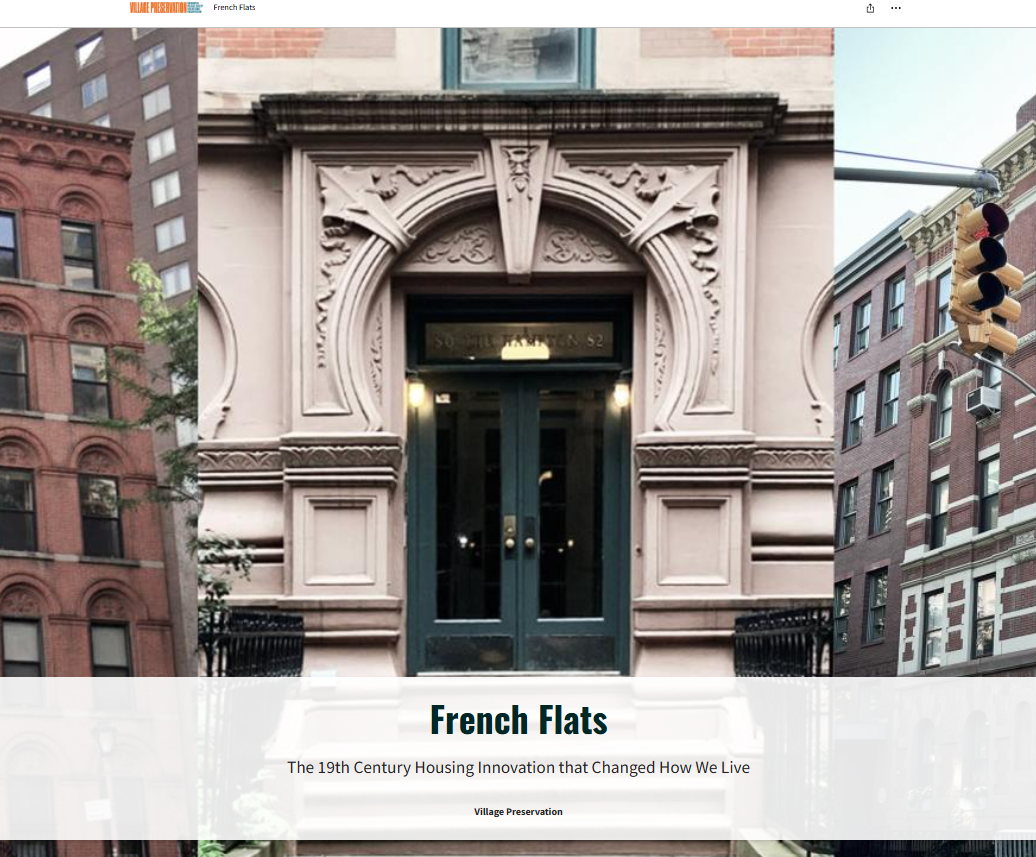
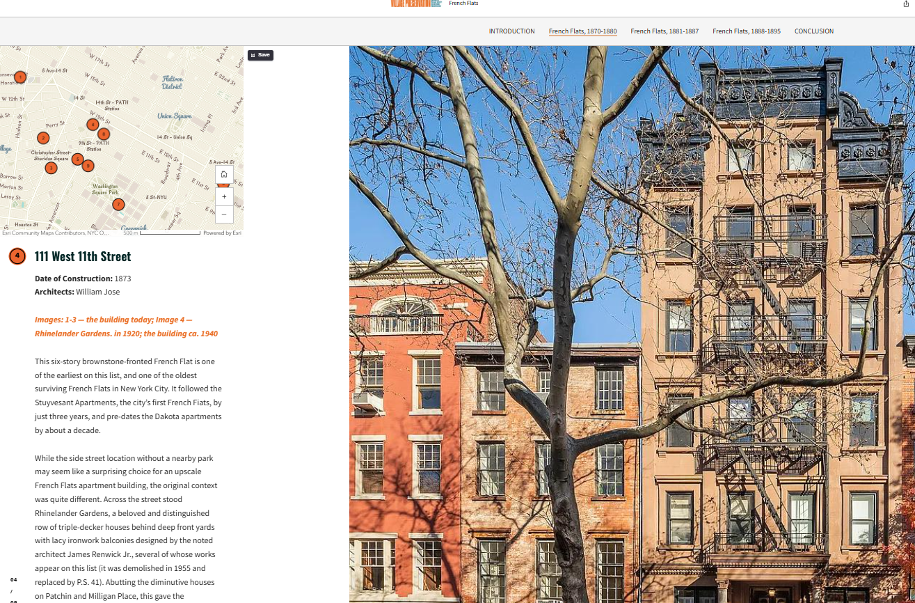
Our French Flats map explores a crucial chapter in New York’s housing history: the introduction of apartment living for everyone in the late 19th century. Known as “French Flats,” these early apartment houses were a radical departure from single-family rowhouses and boarding houses. The map identifies key surviving examples in the Village and East Village, highlighting their architectural features and the societal shifts they represented. For anyone studying urban development or curious about how apartment culture reshaped city life, this map is a rich resource and an excellent starting point for a self-guided tour.
Watching the recording of our free public program How French Flats Changed the Way We Live is a great place to start and learn more. You can also read several of our blog posts on French Flats that go further into detail.
Art Deco Gems of the Village
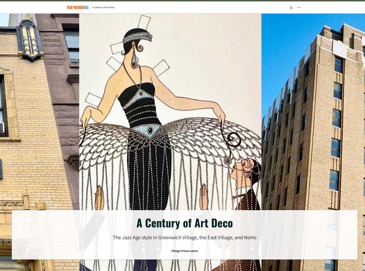
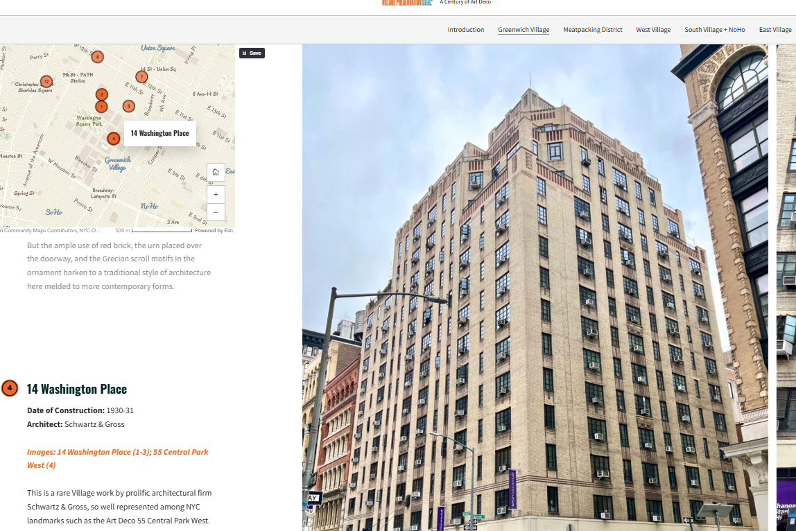
To mark 100 years since the official debut of what became known as Art Deco at the Paris Exposition Internationale des Arts Décoratifs et Industriels Modernes, our Art Deco map brings attention to a style often associated with Midtown skyscrapers and movie palaces but which also left a distinct mark on downtown architecture. This map reveals how the sleek lines and geometric patterns of Art Deco influenced residential, commercial, and institutional buildings in the Village. It’s a visual treat for design lovers and a reminder of how the neighborhood absorbed and adapted global architectural trends during the 1920s and 1930s.
You can read more about all the many facets of Art Deco in our neighborhoods by diving into these blog posts, and we have an exciting program planned about it which you can learn more about here.
How These Maps Can Be Used
These interactive maps aren’t just for armchair historians; they’re practical, engaging tools that anyone can use in multiple ways:
- Self-guided walking tours: Explore at your own pace and discover hidden details on the streets.
- Educational resources: Teachers and students can use the maps to study architecture, urban development, and cultural history.
- Research and preservation: Scholars and advocates can identify historic properties, track architectural styles, and make the case for landmarking.
- Community connection: Residents can learn about their own buildings and blocks, deepening their connection to the neighborhood’s heritage.
A Living, Growing Archive
What makes these maps particularly exciting is how they contribute to Village Preservation’s broader mission of creating a living, evolving digital archive. They allow history to be accessible to anyone, anywhere, while inviting people to physically engage with the neighborhood in new ways.
Whether you’re planning a visit, researching a project, or simply curious about the stories behind the streets you walk every day, these new maps are a doorway into the Village’s past and present. Dive in, explore, and let history unfold block by block.
Explore all our fantastic maps: Village Preservation’s Interactive Maps
What’s your favorite discovery from the maps? Have you used them for a walking tour or found a hidden piece of Village history?